The staging/transition area will probably be somewhere around the Sterling Lift.
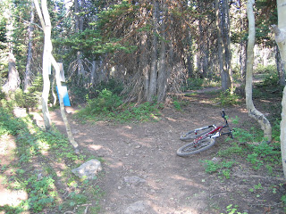
 Typical buff single track with big trees and plenty of shade.
 This is one of the bigger switchbacks on Team Big Bear (TBB).
 After getting off TBB, you follow the single track that parallels the road and pass under this tower.
 Confusion junction near the start of the Flagstar Loop. I don't know which way to go... I think right since I went left and that was wrong.
 If you see this sign, I think you screwed up. Sorry.
And if you see this pond, that's not good either.

But this is good. It's right before the short switchbacks that lead to the start/finsh. Note the soft terra notfirma.
Next, the BS.
Well, I rode the Park City Perfect 10 course this evening and got myself completely lost. Call me stupid but the map on the website did nothing but confuse me, and the course was not marked.
It looks like the course starts at the Sterling Lift, heads west for a short distance and turns left on to the mid-mountain trail just beyond the bridge. The mid-mountain trail is nice singletrack with a few loose rocks at the start, but nothing technical. When you come to an obvious junction in the trail, with a sign that says Team Big Bear, go left. This is nice climbing singletrack with many tight corners, some of which are loose, that winds through tall trees, over roots, rocks and small stumps and will provide welcome relief from the sun. When you come to the first fire road cross it onto the singletrack on the other side, do not turn left or right on the fire road. Continue winding up TBB singletrack for a quite some time until you come to another wide gravel road. At this point, turn left immediately. Do not get on the road. The trail parallels the road and heads east and within a few hundred yards you'll pass under a chair lift. From here on is where I got confused so hopefully it will be marked on Saturday. Course I'm not worried, I'll just follow everybody else. Somehow I ended up on the lower loop of the Flagstaff Loop, not the upper loop. The regular signs in here are confusing and again, the map offered no clear suggestions. I was able to get on the Deer Camp Trail but I ended up at the pond and the map shows I should've been south of the pond. I have no idea how I got goofed up in there. I missed the GS Trees section but did find Naildriver which was loose, dusty, rocky and fast. Naildriver takes you back to the start/finish.
I rode my geared bike and stayed in the middle ring the whole time. On the climbs I used the 3 easiest cogs on the back and kept my heart rate below zone three. I think using a lightweight cross country tire will be risky because of all the sharp rocks. I'm going to take an extra set of tires and definitely carry a tire boot with me. Several of the corners on the descents are loose, rutted and rocky. I don’t know how long a lap will take since I didn’t complete a whole one. I rode 6.6 miles in 60 minutes and made at least 6 wrong turns and had to backtrack, and wander. I’m thinking about 50-55 minutes for myself. You fast guys will probably go 40 + or -.
So that's it. Looks like it'll be a fun course with plenty of good views and relief from the sun. Hope this little bit of info helps and see you Saturday. Oh yeah, and thanks for showing me the way :-)
2 comments:
Thanks Brad, great info! I was thinking of another, cruddy thing that crossed open ski runs when I saw TBB...glad to hear it's not what I though.
It appears the section you're talking about is still there, but it looks like it's being forced into extinction, thankfully.
I forgot to mention the scenery on this course is absolutely beautiful, especially in the Flagstaff area. And, you're going to have a blast on your SS. It appears to be a perfect SS loop.
Post a Comment